The Investigation of bird courses plays a major role at assessments of environmental effects. In the approval phase of offshore wind farms a one year preliminary investigation of bird course with radar equipment is mandatory as well as the continuation of the recording at the stage of construction and operation. RadarCam & RadarEdit gives the possibility to fulfil the requirements of the authority.
RadarCam
allows the image recording, integration and the comfortable configuration of these features. The recording software runs under the operation system Windows.
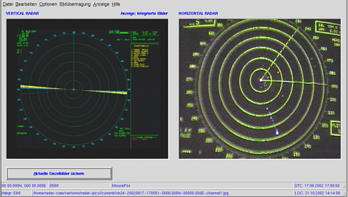
For recording bird paths, there is the possibility of using two radar devices at the same time, one for the horizontal and one for the vertical direction. This is often predetermined by the public authorities in the process of approval for offshore wind farms.
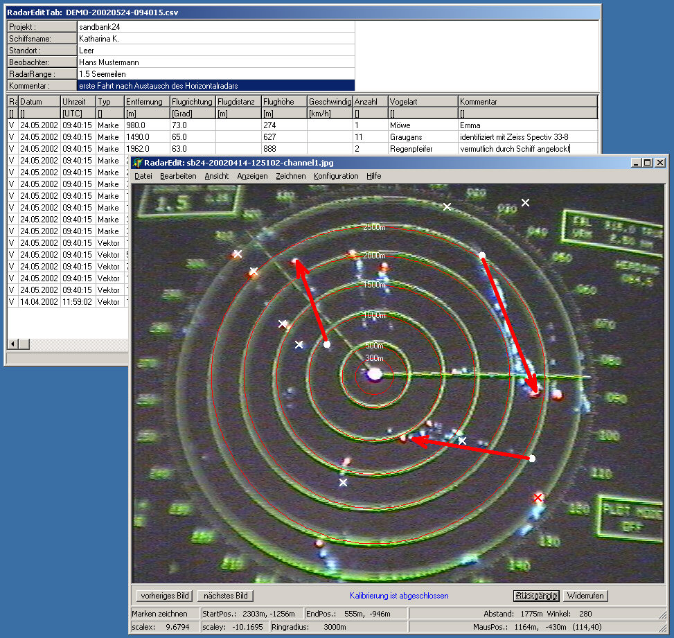
supports the comfortable analysis of recorded images under MS-Windows via an interactive editor. The editor runs independently of RadarCam ad is available separately.